 geo.be Metadata Catalog
National Geographic Institute
Type of resources
Available actions
Topics
INSPIRE themes
federalThemes
Keywords
Contact for the resource
Provided by
Years
Formats
Representation types
Update frequencies
status
Service types
Scale
Resolution
-

Top10Vector – Hydrography is the data set of the Belgian hydrography. This data set includes six classes. First class: waterway kilometre markers of the Belgian navigable waterways. Second class: watercourse surfaces. Third class: watercourse segments. Fourth class: water points, which means points where the water arrives at the surface or disappears into the subsoil. Fifth class: wetlands, which means zones where the soil is saturated or regularly flooded. Sixth class: water surfaces. This data set can be bought via the corresponding hyperlink.
-

Orthophotos are digital aerial photographs that have been adjusted for lens distortion, topographic relief and camera tilt. This cover is renewed every three years.The orthophotographs have a minimal resolution of 50 cm. The dataset is generated from the harmonisation of the datasets owned by the Belgian administrative regions.The dataset is INSPIRE compliant. The dataset is downloadable per NGI mapsheet at scale 1:50000.
-
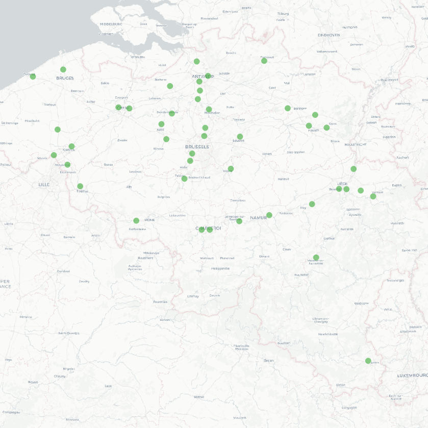
The national wastewater-based epidemiological surveillance of SARS-CoV-2 monitors the SARS-CoV-2 presence in several wastewater treatment plants across Belgium. This download service contains the results per treatment plant since the beginning of the surveillance in September 2020. The results consist in the SARS-CoV2 concentrations over time as well as other data needed for the interpretations such as the flow rates of the treatment plants and their covering populations.
-

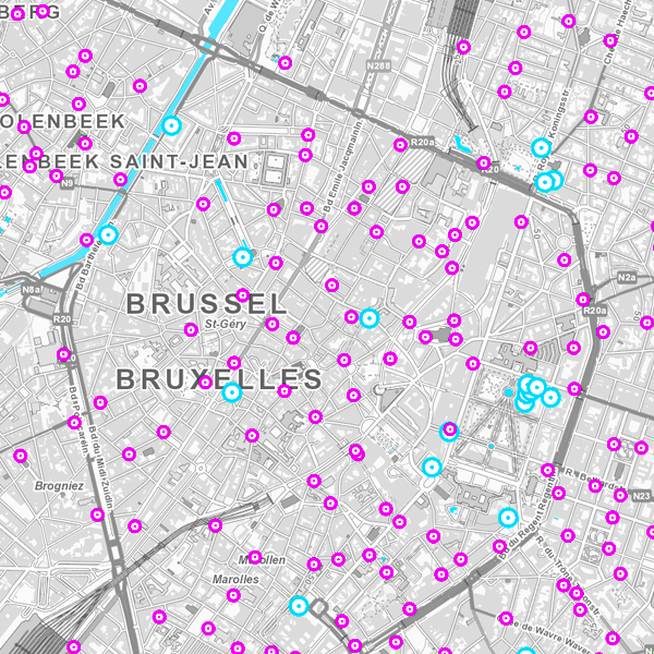
Govroam is a " wifi roaming " solution. This service offers to the users a simple and secure access to the wireless network of their institution, but also to networks of other participating institutions. A user from an organization that participates in govroam will be able to connect to any wireless access point broadcasting govroam. The data provided here makes it possible to locate these access points.
-

The digital terrain model (DTM) is a homogeneous and regular point grid indicating the elevation of the ground level in order to make a model of its surface. The 1m DTM is obtained by interpolation in Lambert 2008 of the raw height data regrouping the source data, in Lambert 72 and at 1m resolution, of the Flemish and Walloon regions. The 5m DTM has as an additional source structure lines and adapted points, during the systematic and continuous updating by photogrammetric surveys. The 20m DTM, available for free download, is obtained by resampling the 1m DTM.
-
The national wastewater-based epidemiological surveillance of SARS-CoV-2 monitors the SARS-CoV-2 presence in several wastewater treatment plants across Belgium. This webservice contains the results per treatment plant since the beginning of the surveillance in September 2020. The results consist in the SARS-CoV2 concentrations over time as well as other data needed for the interpretations such as the flow rates of the treatment plants and their covering populations.
-
Whole of marks whose height with respect to the zero mark of the second general leveling is known.
-

This dataset corresponds to the dataset of address points on the Belgian territory. The result is obtained by merging the three regions on the basis of XML files which has been supplied to BOSA for the cooperation agreement BeStAddress. The dataset is freely downloadable.
-
Orthophotographs are digital aerial photographs that have been adjusted for lens distortion, topographic relief and camera tilt. The orthophotographs are metrically more accurate than common aerial photographs. They are very valuable as reference information and also, for instance, for surveying parcels. This cover is renewed every year by the regions. The orthophotographs are produced on the basis of digital colour aerial photography. The orthophotographs have a minimal resolution of 25 cm. A mosaic of the orthophotos can be consulted on the map viewer or via the viewservices.
-
The entities included in the dataset represent the Belgian hydrographic network in the sense of the Inspire European directive. The dataset comprises one sole WaterCourseLink class and is in accordance with the INSPIRE specifications. The WaterwayLink class represents, in a linear manner, all of the waterways in the Belgian hydrographic network.